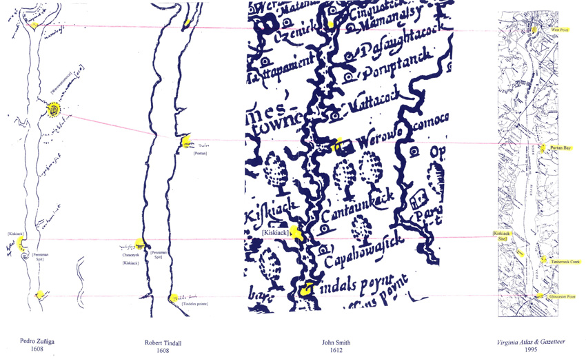
The three historic maps below, the Zuniga, Tindall, and Smith maps, have been rescaled to match the modern map of the York River on the right. The top and bottom red lines show the positions of the two common fixed geographical features of West Point (top) and Gloucester (Tindall's) Point (bottom). Kiskiack is a well known Indian site and is found at the same location on all maps. The same is true for the site of Werowocomoco, which is located on Purton Bay.