HistoryAbout the ProjectInside the ExcavationsVirginia Indian PartnershipResourcesPress ReleasesContactAcknowledgements


Historic Maps

Click on the pictures below to see a larger version of each map.

The Zuņiga map is believed to be a copy of one John Smith sent to England in June of 1608 along with his manuscript of A True Relation. It clearly illustrates the location of the village of "Warawocomoco" as on present-day Purtan Bay. The illustration of two concentric "D"s surrounded by a circle of dots may represent actual landscape features Smith witnessed at the village during his visits. The similarity between this map's representation of James Fort and the archaeological evidence at Jamestown Island suggests similar parallels may be possible between the map and features at Werowocomoco.

Robert TIndall's 1608 map is one of the first historical representations of the environs of the current project area. Tindall was a patron of the Virginia Company and was in the employ of Henry, Prince of Wales. His map illustrates all that was known about Virginia Indian occupations from the voyages of Captain Christopher Newport during the first two years of the Jamestown colony. This map clearly indicates a Native American settlement named "Poetan" composed of two (opposed to only one for the others illustrated) "houses" at a small bay on the north side of Prince Henry's (York) river. This location closely corresponds with the Ripley property.

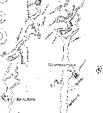
The 1611 engraving of John Smith's map of his explorations during 1608 is remarkable both for its wealth of detail and accuracy. Werowocomoco is represented by a single longhouse (a "king's house") structure just north of what is apparently present-day Purtan Bay. Additionally, the map includes an informative drawing (based largely on the work of John White and Theodore DeBry concerning the Roanoke expedition of the 1580's) of Powhatan and how he "Held this State & Fashion when Capt. Smith was deliuered [sic] to him prisoner 1607."

Information from the above maps can be combined to show two important facts: that they record the site of Werowocomoco as being at the same place; and that the place indicated is modern Purtan Bay. By rescaling the historic maps to correspond to a modern-day map, common points can be identified and compared. When this method was applied to the historic maps shown above, and compared to a modern map, the site of Werowocomoco is clearly seen to correspond to the current Purtan Bay. This is illustrated by the large scale version of the composite map at the left.