 |
 |
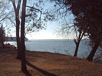
| Looking
southeast down the York River. |

New
Questions and Ongoing Research
The field research at Werowocomoco
has raised several new questions that can only be addressed through
additional analysis and future fieldwork.
- Do the intact layers in the cornfield
contain evidence of Werowocomoco's natural environment and its
residents' foodways in the form of plant materials?
- Ongoing study of soils collected from this area of the site
will help us to answer this question.
- Are the post stains from the cornfield
and the river front related to house patterns?
- Larger-scale excavations in these areas will likely expose additional
post stains that clarify this question.
- Do the ditch features that we exposed
in the corn field date to the Native or the English colonial occupations
at the site?
- Careful examination of one of the early
seventeenth-century maps of Werowocomoco, the Zuniga Map, reveals
what appears as two D-shaped patterns. Might these be related
to the ditches found at the site?
|